Scan to BIM Services High-Accuracy Point Cloud to Revit 3D Models & 2D CAD layouts
Professional Scan to BIM services converting laser scan point cloud datasets into intelligent 3D Revit models and 2D CAD deliverables. Trusted by AEC professionals worldwide.
What It Is & Who It's For
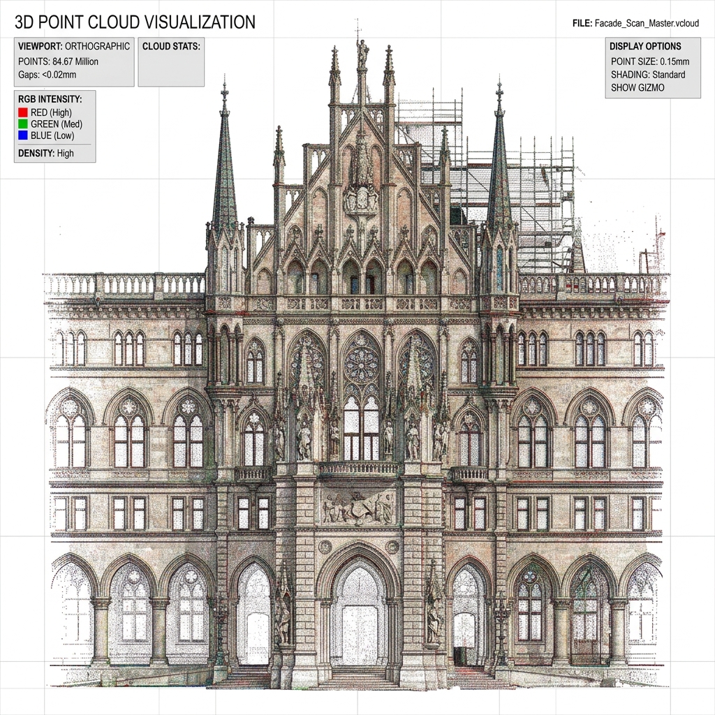
Scan to BIM is the process of capturing real-world physical structures using 3D laser scanner systems and translating the resulting point cloud data into accurate, data-rich 3D Building Information Models (BIM) or 2D CAD formats.
Our services are engineered for architects, structural engineers, MEP consultants, developers, surveyors, and facility managers. We bridge the gap between physical reality and digital assets, ensuring that your renovation, conservation, or management projects start with a precise existing condition foundation.
Scan Data Formats Accepted
We work with raw or structured point cloud files exported from any laser scanner hardware system.
| Format | Standard Name | Description |
|---|---|---|
.E57 | ASTM E57 Standard | Universal high-density point cloud file format |
.RCP / .RCS | Autodesk ReCap Project / Scan | Autodesk native indexed formats for direct Revit import |
.LAS / .LAZ | LASer File Format | Common binary files for lidar spatial point exchange |
.LGS | Leica Geosystems Native | Leica native publisher files for TruView and JetStream |
.PTX / .PTS | ASCII Text Grids | Standard text formats for raw scanner export |
Revit-Based Services
High-precision 3D modeling and coordination workflows built entirely inside the Revit environment.
1. Point Cloud to BIM Modeling
2. As-Built BIM Modeling
3. BIM for Renovation & Retrofit
4. Heritage & Historic Building BIM
5. BIM Coordination & Clash Detection
CAD-Based Services
2D AutoCAD drafting solutions for quick site records and teams not utilizing full 3D BIM.
6. Scan to CAD Drafting
7. As-Built CAD Drawing Services
Frequently Asked Questions
Scan to BIM is the process of 3D laser scanning a physical space or building to capture highly accurate point cloud data, and then converting that data into an intelligent 3D Building Information Model (BIM) using software like Autodesk Revit.
It is for architects, engineers, general contractors, developers, surveyors, and facility managers who require accurate as-built documentation of existing buildings for renovation, design overlay, pre-construction coordination, or asset management.
We accept all standard point cloud formats including .E57, .RCP, .RCS, .LAS, .LAZ, .LGS, .PTX, and .PTS. We can work with raw or indexed files from any major laser scanner brand.
Point Cloud to BIM focuses on modeling existing conditions up to LOD 400 for coordination and design. As-Built BIM (LOD 500) integrates additional records (photos, manual measurements) to deliver data-rich models with COBie asset data for facility management and handover.
BIM for Renovation provides a phased model (existing conditions + proposed design overlay) to serve as a design tool. As-Built BIM is a static record model of the completed building used for operations, maintenance, and facility management.
Timelines vary depending on building scale and Level of Detail (LOD) requested. A typical small to medium commercial building is delivered within 5 to 10 working days, while large-scale structures may take several weeks.
Start Your Scan to BIM Project Today
Get in touch with our team of senior BIM estimators. We will review your laser scan data or site requirements and provide a free project estimate and fixed price quotation within 24 hours.